EarthCARE satellite set to explore the Earth’s skies
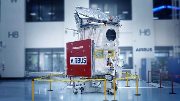
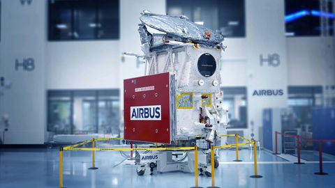
The EarthCARE satellite is set to launch for its climate mission in May. Equipped with four state-of-the-art instruments all brought together with final assembly by the Airbus teams in Friedrichshafen, the satellite is poised to unravel the secrets hidden within Earth's clouds and their role in climate change.
The much anticipated EarthCARE satellite - developed by Airbus for the European Space Agency (ESA) and the Japan Aerospace Exploration Agency (JAXA) - addresses two of the fundamental challenges that we face today: climate change and rising temperatures. Clouds are crucial components of our planet’s climate, acting as a key regulator of the Earth’s temperature, heating or cooling it. However, their formation, behaviour and interaction with radiation from the Earth and the Sun are not yet fully understood. By collecting data on clouds and aerosols - the tiny atmospheric particles such as desert dust, pollution that make up clouds - scientists will be able to reduce uncertainties in climate predictions and improve their numerical models.
“To better understand the complexity of clouds, taking a picture of them is not enough, we need to analyse them in different ways,” says Maximilian Sauer, EarthCARE project leader at Airbus Defence and Space. That’s why four new scientific eyes in the sky have been developed. “The lidar, the radar, the multi-spectral imager and the radiometer will allow us to get a very precise and complete view.”
With its four instruments, EarthCARE will provide unique insights for the scientists. © ESA/ATG medialab
Four cutting-edge instruments to read inside the clouds
The two active instruments, the lidar and the radar, have the same goal: to detect the presence and volume of objects and analyse them. Their main difference lies in the type of electromagnetic waves they emit.
The lidar (ATLID), built by Airbus, is an optical sensor. It uses ultraviolet light waves from pulsed laser beams to detect and map small features. Its measurements are processed to create what’s known as a ‘digital point cloud’ that represents the clouds in 3D. It will give information on cloud tops and the vertical profiles of thin clouds and aerosols. This highly precise data will give the exact position and shape of clouds, including their altitude, thickness, and the type of aerosols. This unique instrument was developed based on Airbus’ experience with the first ever lidar to be used in space on board the Aeolus satellite.
The second active instrument, JAXA’s cloud profiling radar (CPR), uses radio waves instead of laser beams and operates at much longer wavelengths. With its antenna, CPR will penetrate the vertical internal structure of thick clouds, including typhoons, to reveal the velocity of up and down flows, particle distribution and water content. This data will be converted into an image, helping to determine the process, formation and dissipation of clouds.
The multispectral imager (MSI), a camera-like instrument built by SSTL, provides a wider field of vision by capturing high-resolution images in multiple spectral bands. These photos of the horizontal structures of clouds and atmospheric particles give context to the profile measurements of the active instruments. Scientists will thus be able to differentiate between various types of clouds, aerosols and the Earth’s surface.
Finally, to have an overall picture of how clouds influence our climate, the broadband radiometer (BBR) will deliver a crucial dataset on the last parameter: radiation. With its tridirectional view, the Thales BBR will observe the amount of reflected solar radiation and emitted terrestrial heat, known as infrared radiation. This delicate energy balance is an important factor in regulating the Earth’s temperature.
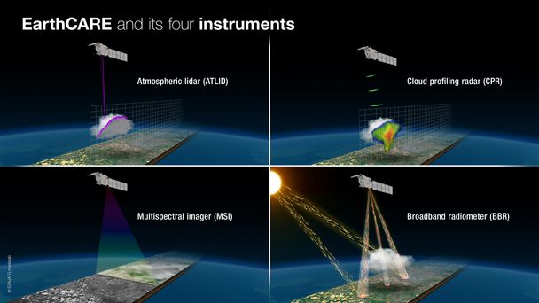
“All four instruments are a must for the mission, each is a mission in itself, but needed in combination to fulfil the mission objective,” says Sauer. By combining observations from the instruments, scientists will have a three-dimensional structure representing the interactions between clouds, aerosols and radiation in the atmosphere.
This holistic view will provide scientists with new insights for developing global climate models of the Earth's radiation balance in the context of the climate crisis.
An innovative design
EarthCARE is the most complex of ESA’s Earth Explorer satellites. As it orbits around 400 kilometres above Earth, getting the laser as close as possible to the clouds of interest presents a number of technical challenges. “This had an impact on the satellite’s shape, which is very thin and streamlined to minimise the effect of air resistance against the residual atmosphere at that altitude. We also couldn't use the classic gold multilayer insulation that covers a spacecraft, as it would have been destroyed by the atomic oxygen still present at this height. For this reason, EarthCARE is wrapped in a kind of white cloth,” Sauer explains.
The precision requirements of this mission also posed design challenges. For example, the laser carries a large number of optical components, beams and splitters that must be positioned very precisely for the laser to work. All these optics will be subjected to vibrations during launch, so engineers had to rigorously test them to ensure that they stay in place and are able to survive the launch.
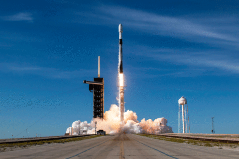
And now all is set for launch in a few weeks’ time: stay tuned on X, Insta, FB or LI to follow the story!
More information on Airbus Space topics
