Orbiting excellence: unveiling the winners of the Satellites for Biodiversity Award
In the realm of conservation, where challenges are as vast as the ecosystems they aim to protect, innovation is key. As we navigate an era defined by unprecedented environmental threats, the role of satellite technology in biodiversity conservation has never been more critical. From tracking habitat changes to monitoring species populations, satellites offer a bird’s-eye view of our planet’s intricate ecosystems, providing invaluable insights into their health and resilience.
The Satellites for Biodiversity Award is a joint initiative by the Airbus Foundation and Connected Conservation Foundation. Individuals and non-profit organisations were invited to submit proposals that leverage very high-resolution satellite data to monitor and safeguard endangered species and their habitats. The selection panel reviewed more than double the number of proposals compared to the previous year, from over 37 countries. The four winning projects have been awarded access to Airbus’ Pléiades and Pléiades Neo satellites’ imagery as well as technical support, funding and data analysis from CCF.
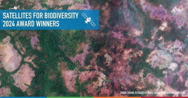
This collaboration will allow the winners to advance in their journeys to protect the habitats of Nepal's greater one-horned rhinos, the wildlife of South Sudan’s untouched terrain, the iconic Andean bear of Peru and the nearly-extinct Ethiopian wolves.
Sustaining suitable habitats for the greater one-horned rhinos
The Chitwan-Parsa Complex in Nepal is home to almost all of the nation’s rhinos (697 out of 752), who live alongside the largest remaining populations of tigers and Asian elephants.
In the vicinity reside approximately 350,000 people who greatly depend on the local biodiversity for revenue from tourism and community forestry programmes. But the threats of advancing agriculture, poaching and invasive plant species are disrupting this ecosystem.
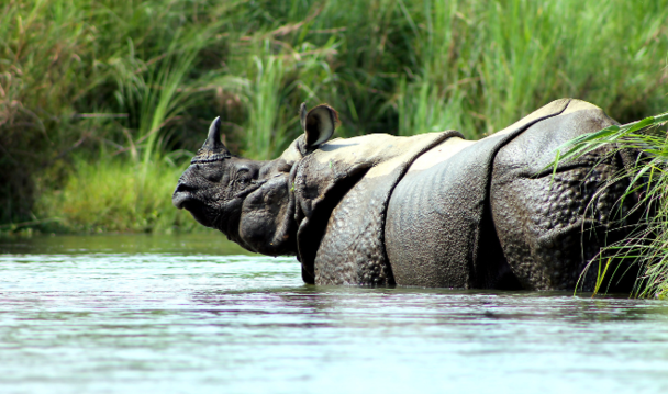
Greater One Horned Rhino © Clare Mansfield
Through a groundbreaking project, the Zoological Society of London (ZSL) intends to harness satellite data to accurately map out the region’s vegetation and evaluate management strategies for this invaluable ecosystem and its biodiversity.
The findings will allow ZSL to develop comprehensive guidelines called the Rhino Habitat Policy Brief that will provide strategic recommendations for efficient and cost-effective rhino and grassland management.
Community collaboration: protecting wildlife in South Sudan’s untouched terrain
Fauna & Flora is a key player in safeguarding the Bangagai and Bire Kpatuos Game Reserves in South Sudan. Home to chimpanzees, giant ground pangolins, white-bellied pangolins, African elephants and leopards, the Bangagai Forest is facing threats from poaching activities. With the help of surrounding communities, Fauna & Flora is providing a physical barrier between core reserves and external threats in order to mitigate the impacts of human activities.
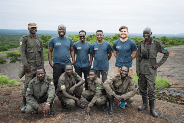
Promoting coexisting between expanding human populations and wildlife © Fauna & Flora
Their project aims to conduct a satellite assessment of the landscape and analyse potential deforestation drivers. The findings will lead to actionable strategies, such as natural resource management practices, which will help the growing population to coexist with wildlife.
Coexisting with Andean Bears in the heart of Peru
In the Kosñipata-Carabaya region of Peru, the iconic Andean Bears – alongside pumas and diminutive dwarf deers – are under threat by habitat fragmentation, illegal poaching and climate change. With the help of local communities, the Conservasion Amazonica is driving a mission to ensure the survival of these threatened species.
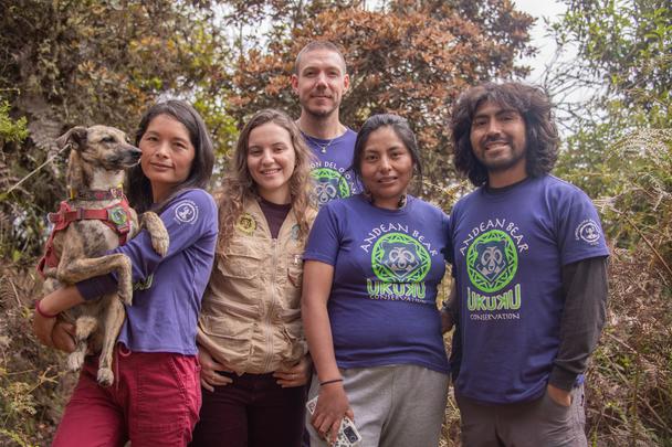
The dedicated team at Conservation Amazonica © Conservation Amazonica
By harnessing spatial data and using on-the-ground wildlife tracking solutions, the team will be able to map out complex bear habitats, trace their movement patterns and monitor the changing landscape. It will allow them to get a comprehensive view of Andean bear home ranges and their interactions with livestock to promote and improve coexistence between local communities and nature.
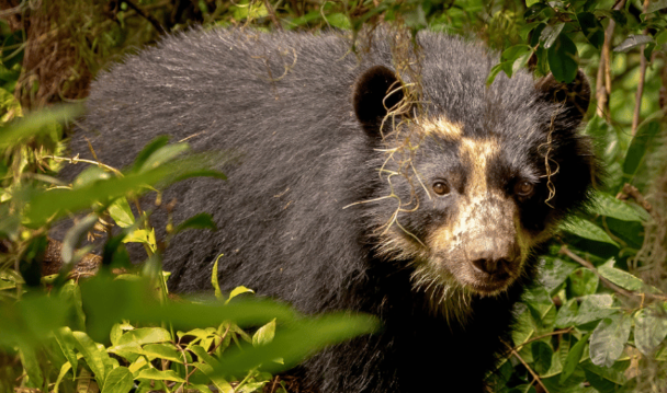
Andean Bear © David Bates
Conserving critically endangered Ethiopian wolves
The Afroalpine realm, in the Bale Mountains National Park, is a sanctuary harbouring more than half of the world’s Ethiopian wolf population. With only 366 wolves remaining, this species is on the brink of extinction. Habitat degradation, overgrazing, encroaching settlements and the looming threat of disease transmission from domestic dogs are all endangering the wolves’ ecosystem in the Bale Mountains.
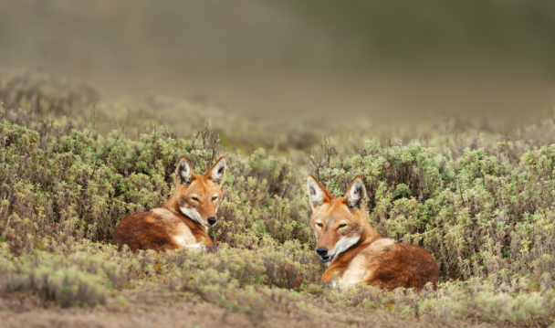
Two rare and endangered Ethiopian Wolves © Dgwildlife
A team from Chulalongkorn University in Thailand and the Ethiopian Biodiversity Institute is planning to harness the power of remote sensing and geographic information systems (GIS) to monitor and protect Ethiopian wolf habitats. Rigorous evaluation methods will allow the team to determine the relationship between habitat pressures, livestock and wolf distribution. Understanding these intricate relationships will inform targeted conservation efforts to address threats at their core.
Learn more about the winners of the Satellites for Biodiversity Awards on the CCF website.
